Hokkaido Shinkansen
Outline
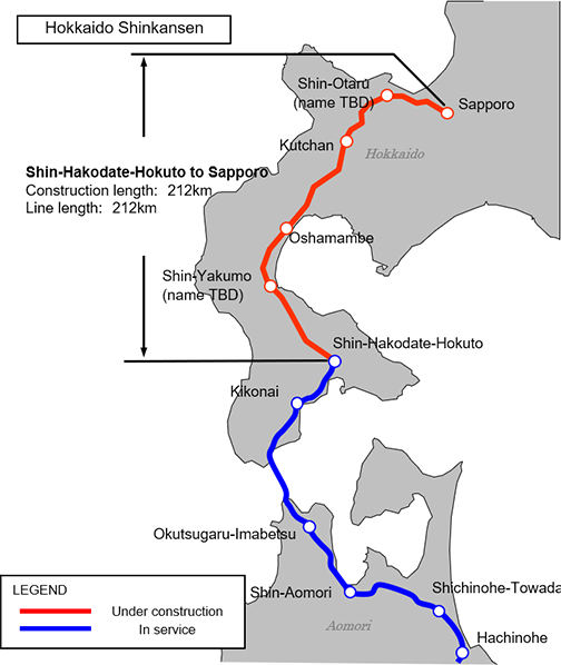
The Hokkaido Shinkansen is to connect from the city of Hakodate to the city of Sapporo via the city of Otaru.
JRTT is currently constructing the section between Shin-Hakodate-Hokuto and Sapporo.
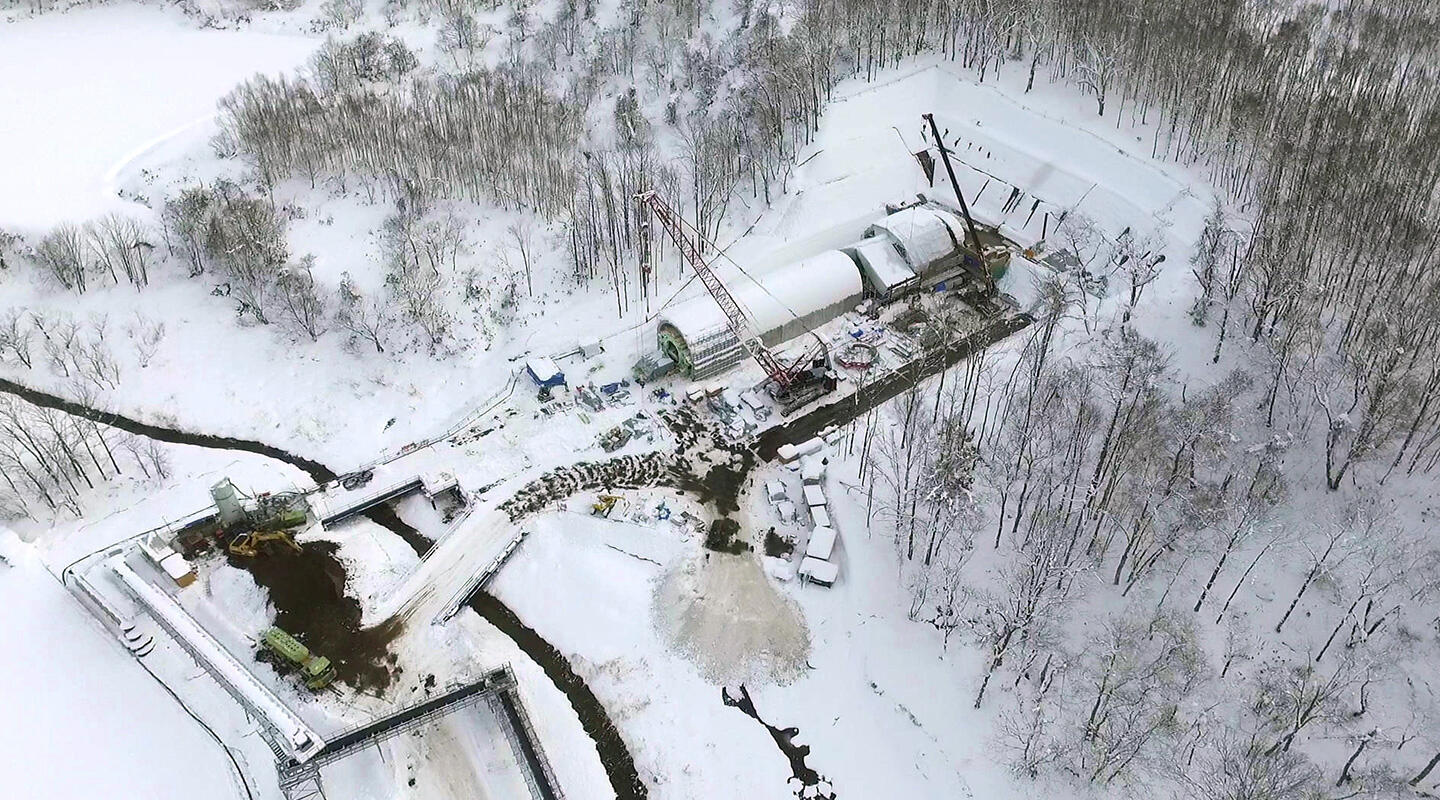
The line length is about 212 km. The construction plan of the line was authorized by the Government in June 2012, and the groundbreaking ceremony was held in August of the same year.
In January 2015, the Government decided its target completion year in March 2031, five years ahead of the original plan under the precondition that the local governments along the line provide utmost cooperative efforts and supports to the project. However, due to unexpectedly poor geology with gigantic boulders, JRTT reported to the Minister of Land, Infrastructure, Transport and Tourism in May 2024, that completion and opening by March 2031 will be extremely difficult.
Through discussions by the advisory group, the following conclusions were announced in March 2025:
- Assuming the risks with high probability of occurrence, the completion and opening year are expected to be around early 2039.
- If further unexpected impact occurs, there is a possibility of additional delays by several years.
- Due to the uncertainly in the current opening outlook, it is appropriate to re-examine the overall schedule and determine, when certain milestone in tunnel penetration is achieved.
Route Map and Main Construction Sections
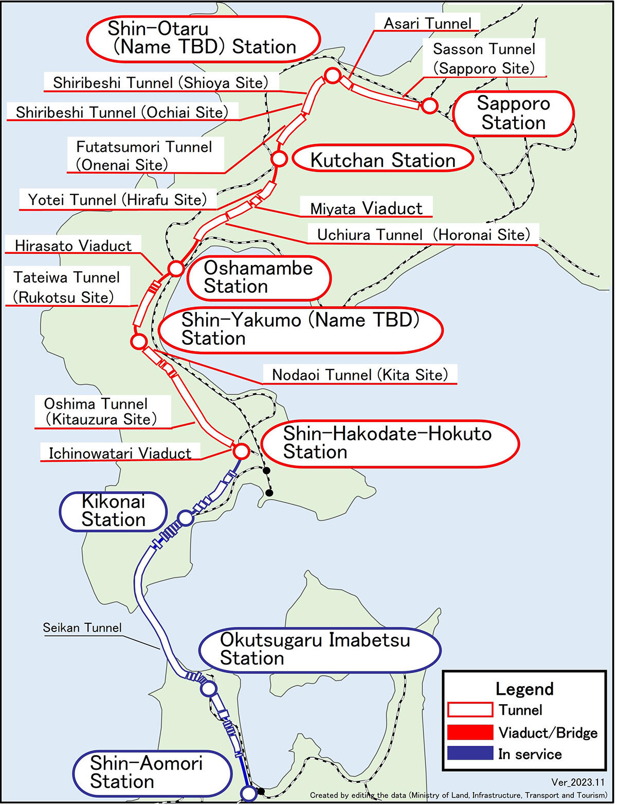
Overview of the Section from Shin-Hakodate-Hokuto to Sapporo
| Construction length | 211.9 km Earthwork: 7.4 km (3%) Bridge: 5.3 km (3%) Viaduct: 30.3 km (14%) Tunnel: 168.9 km (80%) |
|---|---|
| Line length | 212 km |
| Major tunnels | Oshima tunnel (32.7 km), Shiribeshi tunnel (18.0 km), Sasson tunnel (26.2 km) |
| Major bridges | Saranbe river bridge(188m), Yurappu river bridge (217 m), Shiribetsu river bridge (267 m) |
| Municipalities alongside the line | Hokuto, Assabu, Yakumo, Oshamambe, Kuromatsunai, Rankoshi, Toyoura, Niseko, Kutchan, Niki, Akaigawa, Yoichi, Otaru, Sapporo |
| Stations | Shin-Hakodate-Hokuto, Shin-Yakumo (name TBD), Oshamambe, Kutchan, Shin-Otaru (name TBD), Sapporo |